
- Start >
- Groundwater >
- Waterlevel of deep layer >
- Bayern >
- Hohenstadt163A >
- Chart of total period

Chart of total period Hohenstadt163A
Groundwater levels of the total period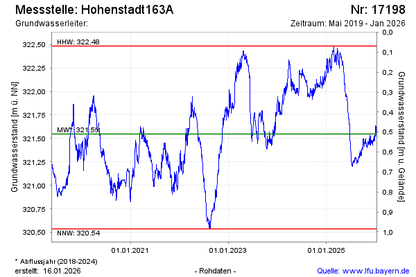
Groundwater level [m above sealevel]: 321.99
Distance to surface [m]:
Last value from 16.05.2024 23:00
Ground level [m above sealevel]: --
| Date | Groundwater level [m above sealevel] |
|---|---|
| 16.05.2024 | 321.98 |
| 15.05.2024 | 321.98 |
| 14.05.2024 | 322.00 |
| 13.05.2024 | 322.02 |
| 12.05.2024 | 322.01 |
| 11.05.2024 | 322.02 |
| 10.05.2024 | 322.01 |
| 09.05.2024 | 322.01 |
© Bayerisches Landesamt für Umwelt 2024