
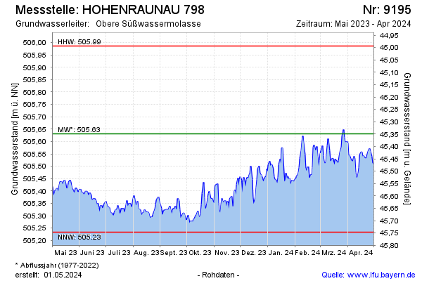
Current data HOHENRAUNAU 798
Groundwater level [m above sealevel]: 505.24
Distance to surface [m]: 45.74
Last value from 14.07.2026 06:00
Ground level [m above sealevel]: 550.98
| Date | Groundwater level [m above sealevel] |
|---|---|
| 14.07.2026 | 505.24 |
| 13.07.2026 | 505.24 |
| 12.07.2026 | 505.23 |
| 11.07.2026 | 505.25 |
| 10.07.2026 | 505.26 |
| 09.07.2026 | 505.26 |
| 08.07.2026 | 505.26 |
| 07.07.2026 | 505.26 |