
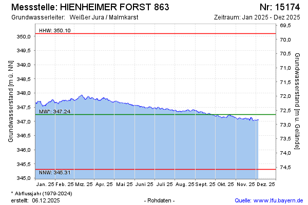
Current data HIENHEIMER FORST 863
Groundwater level [m above sealevel]: 346.30
Distance to surface [m]: 73.59
Last value from 14.07.2026 10:00
Ground level [m above sealevel]: 419.89
| Date | Groundwater level [m above sealevel] |
|---|---|
| 14.07.2026 | 346.31 |
| 13.07.2026 | 346.31 |
| 12.07.2026 | 346.31 |
| 11.07.2026 | 346.32 |
| 10.07.2026 | 346.33 |
| 09.07.2026 | 346.34 |
| 08.07.2026 | 346.34 |
| 07.07.2026 | 346.36 |