
- Start >
- Groundwater >
- Waterlevel of deep layer >
- Bayern >
- GRAIN >
- Chart of total period

Chart of total period GRAIN
Groundwater levels of the total period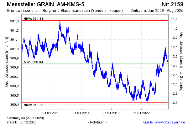
Groundwater level [m above sealevel]: 360.77
Distance to surface [m]: 12.35
Last value from 04.05.2026 04:00
Ground level [m above sealevel]: 373.12
| Date | Groundwater level [m above sealevel] |
|---|---|
| 03.05.2026 | 360.77 |
| 02.05.2026 | 360.75 |
| 01.05.2026 | 360.74 |
| 30.04.2026 | 360.74 |
| 29.04.2026 | 360.75 |
| 28.04.2026 | 360.76 |
| 27.04.2026 | 360.76 |
| 26.04.2026 | 360.76 |
© Bayerisches Landesamt für Umwelt 2026