
- Start >
- Groundwater >
- Waterlevel of deep layer >
- Bayern >
- Göggingen T1flach >
- Current data

Current data Göggingen T1flach
Groundwater levels of the last 12 months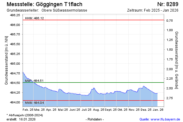
Groundwater level [m above sealevel]: 484.27
Distance to surface [m]: 2.59
Last value from 23.05.2026 08:00
Ground level [m above sealevel]: 486.86
| Date | Groundwater level [m above sealevel] |
|---|---|
| 23.05.2026 | 484.27 |
| 22.05.2026 | 484.27 |
| 21.05.2026 | 484.28 |
| 20.05.2026 | 484.28 |
| 19.05.2026 | 484.28 |
| 18.05.2026 | 484.28 |
| 17.05.2026 | 484.29 |
| 16.05.2026 | 484.29 |
© Bayerisches Landesamt für Umwelt 2026