
- Start >
- Groundwater >
- Waterlevel of deep layer >
- Bayern >
- Fuchsstadt Mu3 >
- Chart of total period

Chart of total period Fuchsstadt Mu3
Groundwater levels of the total period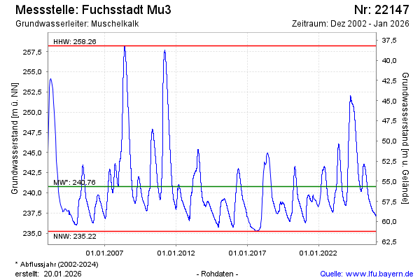
Groundwater level [m above sealevel]: 239.47
Distance to surface [m]: 56.97
Last value from 21.05.2026 10:00
Ground level [m above sealevel]: 296.44
| Date | Groundwater level [m above sealevel] |
|---|---|
| 21.05.2026 | 239.50 |
| 20.05.2026 | 239.52 |
| 19.05.2026 | 239.55 |
| 18.05.2026 | 239.58 |
| 17.05.2026 | 239.61 |
| 16.05.2026 | 239.64 |
| 15.05.2026 | 239.68 |
| 14.05.2026 | 239.72 |
© Bayerisches Landesamt für Umwelt 2026