
- Start >
- Groundwater >
- Waterlevel of deep layer >
- Bayern >
- FORSTERN BR. 1 alt >
- Current data

Current data FORSTERN BR. 1 alt
Groundwater levels of the last 12 months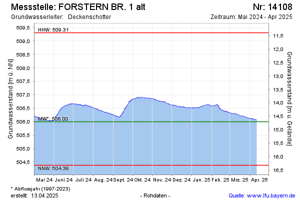
Groundwater level [m above sealevel]: 504.47
Distance to surface [m]: 16.23
Last value from 07.01.2026 10:00
Ground level [m above sealevel]: 520.70
| Date | Groundwater level [m above sealevel] |
|---|---|
| 06.01.2026 | 504.47 |
| 05.01.2026 | 504.47 |
| 04.01.2026 | 504.48 |
| 03.01.2026 | 504.48 |
| 02.01.2026 | 504.49 |
| 01.01.2026 | 504.50 |
| 31.12.2025 | 504.50 |
| 30.12.2025 | 504.50 |
© Bayerisches Landesamt für Umwelt 2026