
- Start >
- Groundwater >
- Waterlevel of deep layer >
- Bayern >
- Flugplatz Manching >
- Current data

Current data Flugplatz Manching
Groundwater levels of the last 12 months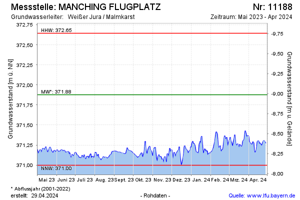
Groundwater level [m above sealevel]: 371.25
Distance to surface [m]: -8.36
Last value from 09.03.2026 07:00
Ground level [m above sealevel]: 362.89
| Date | Groundwater level [m above sealevel] |
|---|---|
| 08.03.2026 | 371.23 |
| 07.03.2026 | 371.23 |
| 06.03.2026 | 371.24 |
| 05.03.2026 | 371.24 |
| 04.03.2026 | 371.21 |
| 03.03.2026 | 371.22 |
| 02.03.2026 | 371.23 |
| 01.03.2026 | 371.22 |
© Bayerisches Landesamt für Umwelt 2026