
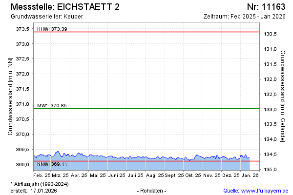
Current data EICHSTAETT 2
Groundwater level [m above sealevel]: 369.09
Distance to surface [m]: 134.74
Last value from 24.06.2026 10:00
Ground level [m above sealevel]: 503.83
| Date | Groundwater level [m above sealevel] |
|---|---|
| 30.06.2026 | 369.08 |
| 29.06.2026 | 369.08 |
| 28.06.2026 | 369.10 |
| 27.06.2026 | 369.09 |
| 26.06.2026 | 369.10 |
| 25.06.2026 | 369.10 |
| 24.06.2026 | 369.10 |
| 23.06.2026 | 369.09 |