
- Start >
- Groundwater >
- Waterlevel of deep layer >
- Bayern >
- Buchschwabach B4 >
- Current data

Current data Buchschwabach B4
Groundwater levels of the last 12 months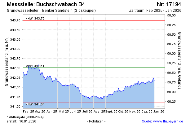
Groundwater level [m above sealevel]: 342.30
Distance to surface [m]: 59.58
Last value from 21.05.2026 10:00
Ground level [m above sealevel]: 401.88
| Date | Groundwater level [m above sealevel] |
|---|---|
| 21.05.2026 | 342.31 |
| 20.05.2026 | 342.33 |
| 19.05.2026 | 342.35 |
| 18.05.2026 | 342.37 |
| 17.05.2026 | 342.37 |
| 16.05.2026 | 342.39 |
| 15.05.2026 | 342.42 |
| 14.05.2026 | 342.43 |
© Bayerisches Landesamt für Umwelt 2026