
- Start >
- Groundwater >
- Waterlevel of deep layer >
- Bayern >
- Bruderamming >
- Chart of total period

Chart of total period Bruderamming
Groundwater levels of the total period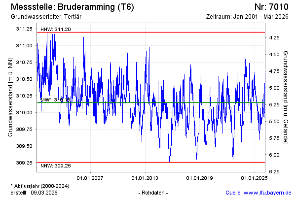
note
GW Messstelle im Grundnetz
Groundwater level [m above sealevel]: 309.66
Distance to surface [m]: 5.71
Last value from 23.05.2026 19:11
Ground level [m above sealevel]: 315.37
| Date | Groundwater level [m above sealevel] |
|---|---|
| 23.05.2026 | 309.68 |
| 22.05.2026 | 309.69 |
| 21.05.2026 | 309.70 |
| 20.05.2026 | 309.71 |
| 19.05.2026 | 309.72 |
| 18.05.2026 | 309.73 |
| 17.05.2026 | 309.74 |
| 16.05.2026 | 309.76 |
© Bayerisches Landesamt für Umwelt 2026