
- Start >
- Groundwater >
- Waterlevel of deep layer >
- Bayern >
- Bollstadt W1 >
- Chart of total period

Chart of total period Bollstadt W1
Groundwater levels of the total period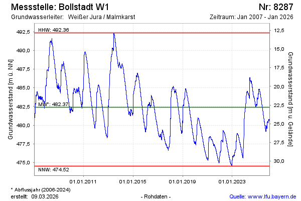
note
Derzeit keine aktuellen Daten!
Groundwater level [m above sealevel]: 485.03
Distance to surface [m]: 20.16
Last value from 17.03.2026 12:00
Ground level [m above sealevel]: 505.19
| Date | Groundwater level [m above sealevel] |
|---|---|
| 17.03.2026 | 485.03 |
| 16.03.2026 | 485.03 |
| 15.03.2026 | 485.04 |
| 14.03.2026 | 485.07 |
| 13.03.2026 | 485.00 |
| 12.03.2026 | 484.94 |
| 11.03.2026 | 484.93 |
| 10.03.2026 | 484.91 |
© Bayerisches Landesamt für Umwelt 2026