
- Start >
- Groundwater >
- Waterlevel of deep layer >
- Bayern >
- Ammerfeld, B1 >
- Chart of total period

Chart of total period Ammerfeld, B1
Groundwater levels of the total period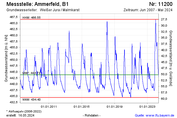
Groundwater level [m above sealevel]: 441.03
Distance to surface [m]: 52.97
Last value from 21.01.2026 07:00
Ground level [m above sealevel]: 494.00
| Date | Groundwater level [m above sealevel] |
|---|---|
| 20.01.2026 | 440.90 |
| 19.01.2026 | 440.79 |
| 18.01.2026 | 440.70 |
| 17.01.2026 | 440.60 |
| 16.01.2026 | 440.51 |
| 15.01.2026 | 440.39 |
| 14.01.2026 | 440.27 |
| 13.01.2026 | 440.19 |
© Bayerisches Landesamt für Umwelt 2026