
- Start >
- Groundwater >
- Waterlevel of deep layer >
- Bayern >
- ADELSRIED TA 1-T1 >
- Chart of total period

Chart of total period ADELSRIED TA 1-T1
Groundwater levels of the total period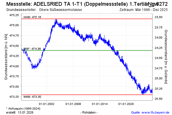
Groundwater level [m above sealevel]: 473.34
Distance to surface [m]: 25.36
Last value from 26.03.2026 14:39
Ground level [m above sealevel]: 498.70
| Date | Groundwater level [m above sealevel] |
|---|---|
| 26.03.2026 | 473.35 |
| 25.03.2026 | 473.36 |
| 24.03.2026 | 473.32 |
| 23.03.2026 | 473.33 |
| 22.03.2026 | 473.35 |
| 21.03.2026 | 473.34 |
| 20.03.2026 | 473.33 |
| 19.03.2026 | 473.32 |
© Bayerisches Landesamt für Umwelt 2026