
- Start >
- Rivers >
- Waterlevel >
- Untere Donau >
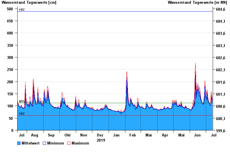
- Schlehdorf >
- Chart of year

Chart of year Schlehdorf / Loisach
Waterlevel from 14.07.2019 to 13.07.2020
| Date | Mean value [cm] | Maximum [cm] | Minimum [cm] |
|---|---|---|---|
| 13.07.2020 | 119 | 125 | 114 |
| 12.07.2020 | 138 | 155 | 125 |
| 11.07.2020 | 147 | 159 | 137 |
| 10.07.2020 | 107 | 154 | 102 |
| 09.07.2020 | 105 | 109 | 100 |
| 08.07.2020 | 108 | 110 | 104 |
| 07.07.2020 | 112 | 115 | 110 |
© Bayerisches Landesamt für Umwelt 2024