
- Start >
- Rivers >
- Waterlevel >
- Untere Donau >
- Plattling >
- Chart of year

Chart of year Plattling / Isar
Waterlevel from 12.08.2020 to 11.08.2021
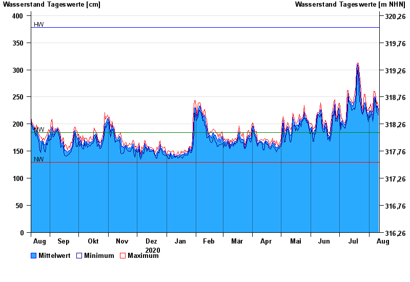
| Date | Mean value [cm] | Maximum [cm] | Minimum [cm] |
|---|---|---|---|
| 11.08.2021 | 221 | 225 | 216 |
| 10.08.2021 | 233 | 240 | 220 |
| 09.08.2021 | 230 | 237 | 223 |
| 08.08.2021 | 241 | 249 | 237 |
| 07.08.2021 | 251 | 260 | 247 |
| 06.08.2021 | 247 | 261 | 223 |
| 05.08.2021 | 216 | 231 | 205 |
© Bayerisches Landesamt für Umwelt 2024