
- Start >
- Rivers >
- Waterlevel >
- Untere Donau >
- Pfatter >
- Chart of year

Chart of year Pfatter / Donau
Waterlevel from 28.04.2024 to 27.04.2025
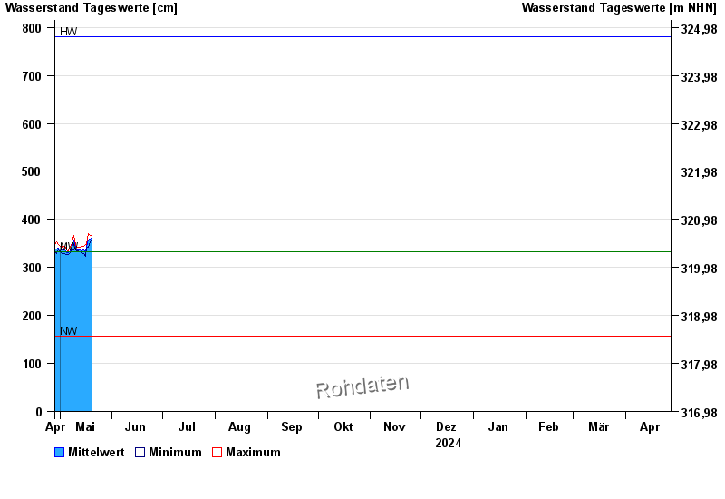
| Date | Mean value [cm] | Maximum [cm] | Minimum [cm] |
|---|---|---|---|
| 09.05.2024 | 350 | 367 | 337 |
| 08.05.2024 | 342 | 352 | 338 |
| 07.05.2024 | 335 | 342 | 330 |
| 06.05.2024 | 330 | 334 | 327 |
| 05.05.2024 | 330 | 336 | 327 |
| 04.05.2024 | 336 | 344 | 329 |
| 03.05.2024 | 336 | 345 | 330 |
© Bayerisches Landesamt für Umwelt 2024