
- Start >
- Rivers >
- Waterlevel >
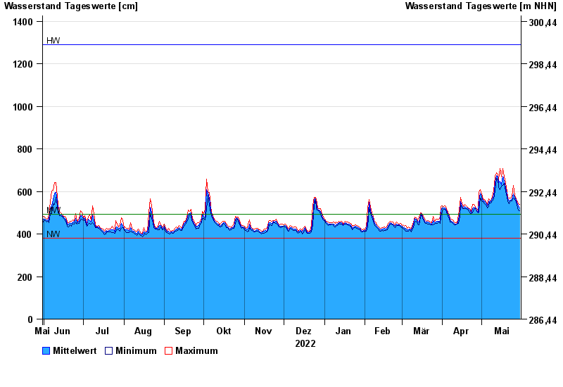
- Untere Donau >
- Passau >
- Chart of year

Chart of year Passau / Donau
Waterlevel from 31.05.2022 to 30.05.2023
| Date | Mean value [cm] | Maximum [cm] | Minimum [cm] |
|---|---|---|---|
| 30.05.2023 | 521 | 539 | 510 |
| 29.05.2023 | 531 | 543 | 513 |
| 28.05.2023 | 547 | 556 | 537 |
| 27.05.2023 | 558 | 567 | 549 |
| 26.05.2023 | 572 | 582 | 566 |
| 25.05.2023 | 588 | 630 | 568 |
| 24.05.2023 | 565 | 578 | 557 |
© Bayerisches Landesamt für Umwelt 2024