
- Start >
- Rivers >
- Waterlevel >
- Untere Donau >
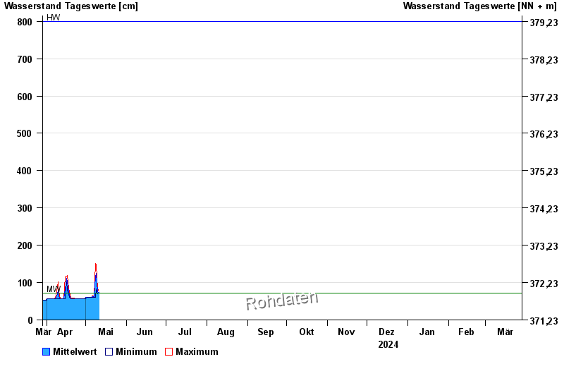
- Mühldorf >
- Chart of year

Chart of year Mühldorf / Inn
Waterlevel from 29.03.2024 to 28.03.2025
| Date | Mean value [cm] | Maximum [cm] | Minimum [cm] |
|---|---|---|---|
| 19.06.2024 | 277 | 326 | 218 |
| 18.06.2024 | 259 | 282 | 237 |
| 17.06.2024 | 211 | 242 | 183 |
| 16.06.2024 | 183 | 199 | 161 |
| 15.06.2024 | 185 | 202 | 155 |
| 14.06.2024 | 210 | 223 | 198 |
| 13.06.2024 | 244 | 263 | 217 |
© Bayerisches Landesamt für Umwelt 2024