
- Start >
- Rivers >
- Waterlevel >
- Untere Donau >
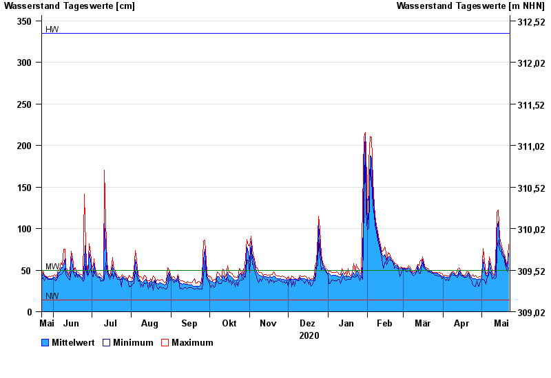
- Hörmannsberg >
- Chart of year

Chart of year Hörmannsberg / Gaißa
Waterlevel from 23.05.2020 to 22.05.2021
| Date | Mean value [cm] | Maximum [cm] | Minimum [cm] |
|---|---|---|---|
| 22.05.2021 | 70 | 81 | 53 |
| 21.05.2021 | 53 | 54 | 48 |
| 20.05.2021 | 56 | 60 | 54 |
| 19.05.2021 | 62 | 66 | 56 |
| 18.05.2021 | 68 | 70 | 66 |
| 17.05.2021 | 70 | 75 | 67 |
| 16.05.2021 | 77 | 82 | 73 |
© Bayerisches Landesamt für Umwelt 2024