
- Start >
- Rivers >
- Waterlevel >
- Untere Donau >
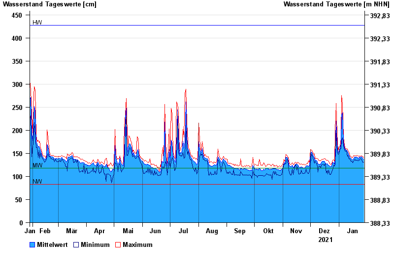
- Furth im Wald >
- Chart of year

Chart of year Furth im Wald / Chamb
Waterlevel from 29.01.2021 to 28.01.2022
| Date | Mean value [cm] | Maximum [cm] | Minimum [cm] |
|---|---|---|---|
| 28.01.2022 | 137 | 140 | 131 |
| 27.01.2022 | 139 | 143 | 131 |
| 26.01.2022 | 142 | 145 | 136 |
| 25.01.2022 | 142 | 145 | 138 |
| 24.01.2022 | 141 | 144 | 138 |
| 23.01.2022 | 142 | 145 | 135 |
| 22.01.2022 | 137 | 143 | 134 |
© Bayerisches Landesamt für Umwelt 2024