
- Start >
- Rivers >
- Waterlevel >
- Untere Donau >
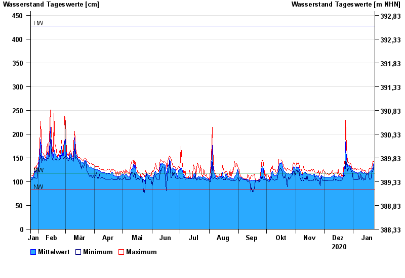
- Furth im Wald >
- Chart of year

Chart of year Furth im Wald / Chamb
Waterlevel from 24.01.2020 to 23.01.2021
| Date | Mean value [cm] | Maximum [cm] | Minimum [cm] |
|---|---|---|---|
| 23.01.2021 | 138 | 142 | 133 |
| 22.01.2021 | 131 | 143 | 121 |
| 21.01.2021 | 124 | 129 | 122 |
| 20.01.2021 | 123 | 127 | 107 |
| 19.01.2021 | 122 | 128 | 105 |
| 18.01.2021 | 120 | 129 | 105 |
| 17.01.2021 | 116 | 116 | 116 |
© Bayerisches Landesamt für Umwelt 2024