
- Start >
- Rivers >
- Waterlevel >
- Untere Donau >
- Furth im Wald >
- Chart of year

Chart of year Furth im Wald / Chamb
Waterlevel from 01.01.2019 to 31.12.2019
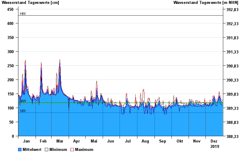
| Date | Mean value [cm] | Maximum [cm] | Minimum [cm] |
|---|---|---|---|
| 31.12.2019 | 117 | 124 | 106 |
| 30.12.2019 | 122 | 129 | 109 |
| 29.12.2019 | 123 | 130 | 114 |
| 28.12.2019 | 126 | 128 | 113 |
| 27.12.2019 | 131 | 135 | 113 |
| 26.12.2019 | 140 | 147 | 133 |
| 25.12.2019 | 144 | 158 | 138 |
© Bayerisches Landesamt für Umwelt 2024