
- Start >
- Rivers >
- Waterlevel >
- Untere Donau >
- Eberhardsreuth >
- Chart of year

Chart of year Eberhardsreuth / Mitternacher Ohe
Waterlevel from 01.01.2023 to 31.12.2023
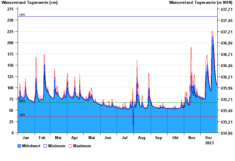
| Date | Mean value [cm] | Maximum [cm] | Minimum [cm] |
|---|---|---|---|
| 31.12.2023 | 105 | 107 | 103 |
| 30.12.2023 | 110 | 113 | 107 |
| 29.12.2023 | 116 | 121 | 113 |
| 28.12.2023 | 124 | 129 | 120 |
| 27.12.2023 | 135 | 143 | 129 |
| 26.12.2023 | 156 | 171 | 142 |
| 25.12.2023 | 185 | 196 | 171 |
© Bayerisches Landesamt für Umwelt 2024