
- Start >
- Rivers >
- Waterlevel >
- Naab - Regen >
- Trausnitz u. d. Mühle >
- Chart of year

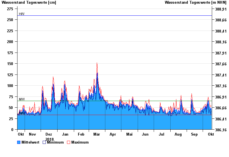
Chart of year Trausnitz u. d. Mühle / Pfreimd
Waterlevel from 18.10.2018 to 17.10.2019
| Date | Mean value [cm] | Maximum [cm] | Minimum [cm] |
|---|---|---|---|
| 17.10.2019 | 48 | 53 | 43 |
| 16.10.2019 | 45 | 54 | 34 |
| 15.10.2019 | 50 | 52 | 45 |
| 14.10.2019 | 48 | 54 | 46 |
| 13.10.2019 | 51 | 61 | 42 |
| 12.10.2019 | 58 | 67 | 37 |
| 11.10.2019 | 67 | 74 | 57 |
© Bayerisches Landesamt für Umwelt 2024