
- Start >
- Rivers >
- Waterlevel >
- Naab - Regen >
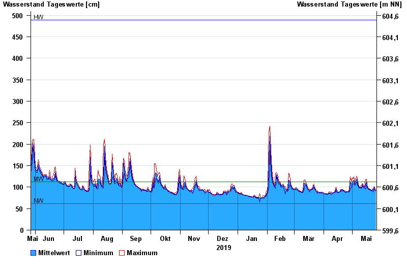
- Schlehdorf >
- Chart of year

Chart of year Schlehdorf / Loisach
Waterlevel from 27.05.2019 to 26.05.2020
| Date | Mean value [cm] | Maximum [cm] | Minimum [cm] |
|---|---|---|---|
| 26.05.2020 | 92 | 93 | 91 |
| 25.05.2020 | 94 | 99 | 93 |
| 24.05.2020 | 99 | 102 | 96 |
| 23.05.2020 | 93 | 98 | 89 |
| 22.05.2020 | 92 | 92 | 91 |
| 21.05.2020 | 93 | 94 | 92 |
| 20.05.2020 | 94 | 95 | 93 |
© Bayerisches Landesamt für Umwelt 2024