
- Start >
- Rivers >
- Waterlevel >
- Unterer Main >
- Schweinhof >
- Chart of year

Chart of year Schweinhof / Brend
Waterlevel from 01.01.2022 to 31.12.2022
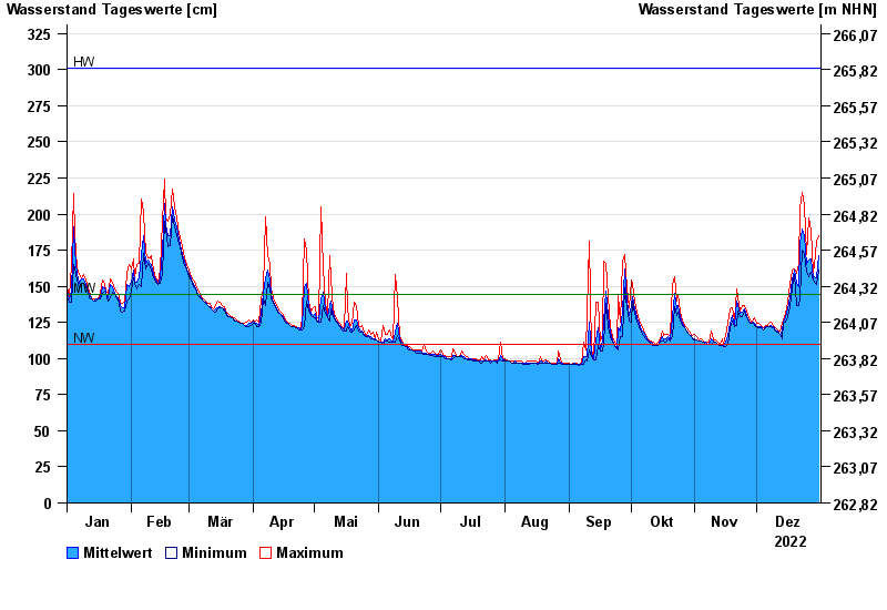
| Date | Mean value [cm] | Maximum [cm] | Minimum [cm] |
|---|---|---|---|
| 31.12.2022 | 171 | 185 | 161 |
| 30.12.2022 | 156 | 181 | 151 |
| 29.12.2022 | 157 | 164 | 153 |
| 28.12.2022 | 156 | 160 | 154 |
| 27.12.2022 | 169 | 189 | 160 |
| 26.12.2022 | 168 | 197 | 157 |
| 25.12.2022 | 165 | 172 | 160 |
© Bayerisches Landesamt für Umwelt 2024