
- Start >
- Rivers >
- Waterlevel >
- Unterer Main >
- Sachsenheim >
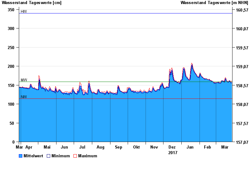
- Chart of year

Chart of year Sachsenheim / Wern
Waterlevel from 29.03.2017 to 28.03.2018
| Date | Mean value [cm] | Maximum [cm] | Minimum [cm] |
|---|---|---|---|
| 28.03.2018 | 157 | 161 | 156 |
| 27.03.2018 | 156 | 158 | 155 |
| 26.03.2018 | 158 | 160 | 157 |
| 25.03.2018 | 160 | 161 | 159 |
| 24.03.2018 | 161 | 162 | 160 |
| 23.03.2018 | 160 | 161 | 159 |
| 22.03.2018 | 158 | 159 | 157 |
© Bayerisches Landesamt für Umwelt 2024