
- Start >
- Rivers >
- Waterlevel >
- Unterer Main >
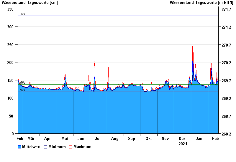
- Bad Königshofen im Grabfeld >
- Chart of year

Chart of year Bad Königshofen im Grabfeld / Fränkische Saale
Waterlevel from 20.02.2021 to 19.02.2022
note
Biberaktivität: Werte können durch Aufstau beeinflusst sein
| Date | Mean value [cm] | Maximum [cm] | Minimum [cm] |
|---|---|---|---|
| 19.02.2022 | 144 | 148 | 140 |
| 18.02.2022 | 148 | 153 | 143 |
| 17.02.2022 | 154 | 171 | 139 |
| 16.02.2022 | 137 | 139 | 136 |
| 15.02.2022 | 137 | 138 | 136 |
| 14.02.2022 | 139 | 139 | 138 |
| 13.02.2022 | 140 | 141 | 139 |
© Bayerisches Landesamt für Umwelt 2024