
- Start >
- Rivers >
- Waterlevel >
- Unterer Main >
- Alzenau >
- Chart of year

Chart of year Alzenau / Kahl
Waterlevel from 20.04.2024 to 19.04.2025
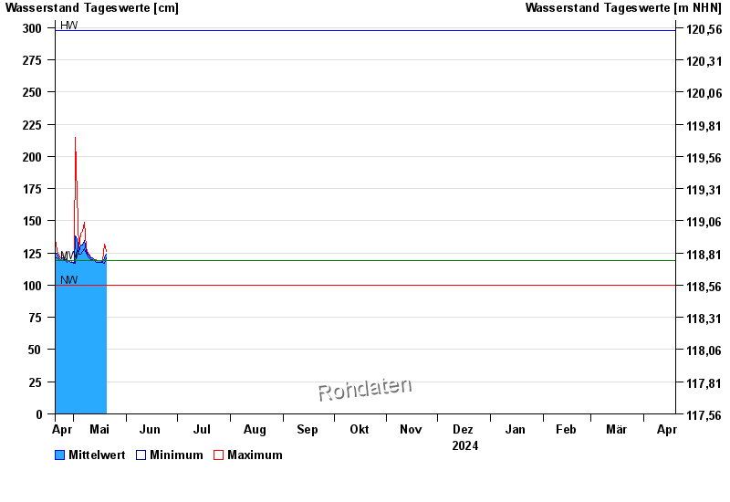
| Date | Mean value [cm] | Maximum [cm] | Minimum [cm] |
|---|---|---|---|
| 03.05.2024 | 158 | 170 | 151 |
| 02.05.2024 | 138 | 215 | 117 |
| 01.05.2024 | 118 | 118 | 117 |
| 30.04.2024 | 118 | 118 | 118 |
| 29.04.2024 | 118 | 119 | 118 |
| 28.04.2024 | 119 | 119 | 119 |
| 27.04.2024 | 120 | 120 | 118 |
© Bayerisches Landesamt für Umwelt 2024