
- Start >
- Rivers >
- Waterlevel >
- Obere Donau >
- Heroldingen >
- Chart of year

Chart of year Heroldingen / Wörnitz
Waterlevel from 01.01.2022 to 31.12.2022
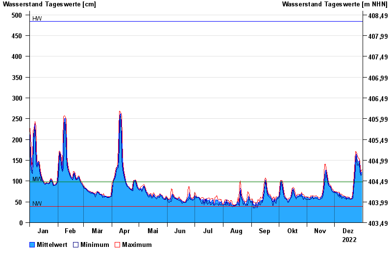
| Date | Mean value [cm] | Maximum [cm] | Minimum [cm] |
|---|---|---|---|
| 31.12.2022 | 122 | 128 | 117 |
| 30.12.2022 | 117 | 122 | 113 |
| 29.12.2022 | 132 | 144 | 122 |
| 28.12.2022 | 149 | 153 | 144 |
| 27.12.2022 | 147 | 155 | 138 |
| 26.12.2022 | 148 | 159 | 138 |
| 25.12.2022 | 165 | 170 | 159 |
© Bayerisches Landesamt für Umwelt 2024