
- Start >
- Rivers >
- Waterlevel >
- Obere Donau >
- Freising >
- Current values

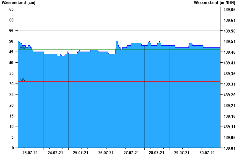
Current values Freising / Schleifermoosach
Waterlevel from 23.07.2021 to 30.07.2021
| Date | Waterlevel [cm] |
|---|---|
| 31.07.2021 00:45 | 47 |
| 31.07.2021 00:30 | 47 |
| 31.07.2021 00:15 | 47 |
| 31.07.2021 00:00 | 47 |
| 30.07.2021 23:45 | 47 |
| 30.07.2021 23:30 | 47 |
| 30.07.2021 23:15 | 47 |
© Bayerisches Landesamt für Umwelt 2024