
- Start >
- Rivers >
- Waterlevel >
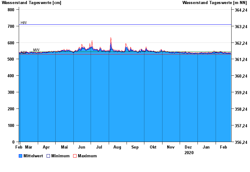
- Obere Donau >
- Eschelbach >
- Chart of year

Chart of year Eschelbach / Inn
Waterlevel from 28.02.2020 to 27.02.2021
| Date | Mean value [cm] | Maximum [cm] | Minimum [cm] |
|---|---|---|---|
| 27.02.2021 | 537 | 539 | 536 |
| 26.02.2021 | 536 | 537 | 533 |
| 25.02.2021 | 537 | 540 | 533 |
| 24.02.2021 | 536 | 539 | 534 |
| 23.02.2021 | 537 | 539 | 535 |
| 22.02.2021 | 536 | 538 | 533 |
| 21.02.2021 | 536 | 537 | 534 |
© Bayerisches Landesamt für Umwelt 2024