
- Start >
- Rivers >
- Waterlevel >
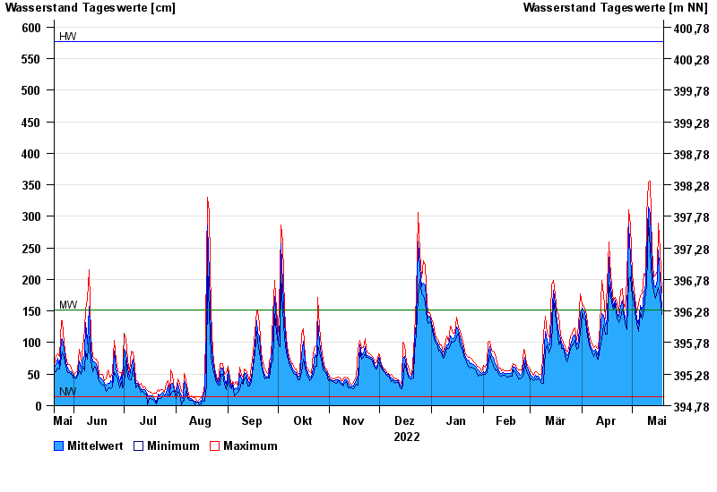
- Obere Donau >
- Donauwörth >
- Chart of year

Chart of year Donauwörth / Donau
Waterlevel from 20.05.2022 to 19.05.2023
| Date | Mean value [cm] | Maximum [cm] | Minimum [cm] |
|---|---|---|---|
| 19.05.2023 | 156 | 179 | 145 |
| 18.05.2023 | 200 | 246 | 170 |
| 17.05.2023 | 247 | 289 | 187 |
| 16.05.2023 | 199 | 213 | 183 |
| 15.05.2023 | 187 | 207 | 170 |
| 14.05.2023 | 191 | 204 | 180 |
| 13.05.2023 | 220 | 248 | 197 |
© Bayerisches Landesamt für Umwelt 2024