
- Start >
- Rivers >
- Waterlevel >
- Isar >
- Schmerold >
- Chart of year

Chart of year Schmerold / Mangfall
Waterlevel from 08.12.2022 to 07.12.2023
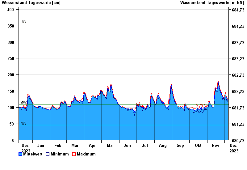
| Date | Mean value [cm] | Maximum [cm] | Minimum [cm] |
|---|---|---|---|
| 07.12.2023 | 122 | 127 | 115 |
| 06.12.2023 | 125 | 128 | 123 |
| 05.12.2023 | 126 | 131 | 120 |
| 04.12.2023 | 130 | 134 | 123 |
| 03.12.2023 | 137 | 141 | 133 |
| 02.12.2023 | 140 | 147 | 131 |
| 01.12.2023 | 130 | 137 | 124 |
© Bayerisches Landesamt für Umwelt 2024