
- Start >
- Rivers >
- Waterlevel >
- Isar >
- Schlehdorf >
- Chart of year

Chart of year Schlehdorf / Loisach
Waterlevel from 21.10.2021 to 20.10.2022
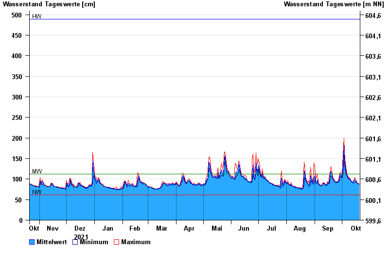
| Date | Mean value [cm] | Maximum [cm] | Minimum [cm] |
|---|---|---|---|
| 20.10.2022 | 88 | 89 | 87 |
| 19.10.2022 | 89 | 90 | 89 |
| 18.10.2022 | 90 | 91 | 90 |
| 17.10.2022 | 92 | 94 | 91 |
| 16.10.2022 | 96 | 99 | 93 |
| 15.10.2022 | 99 | 104 | 92 |
| 14.10.2022 | 93 | 97 | 90 |
© Bayerisches Landesamt für Umwelt 2024