
- Start >
- Rivers >
- Waterlevel >
- Isar >
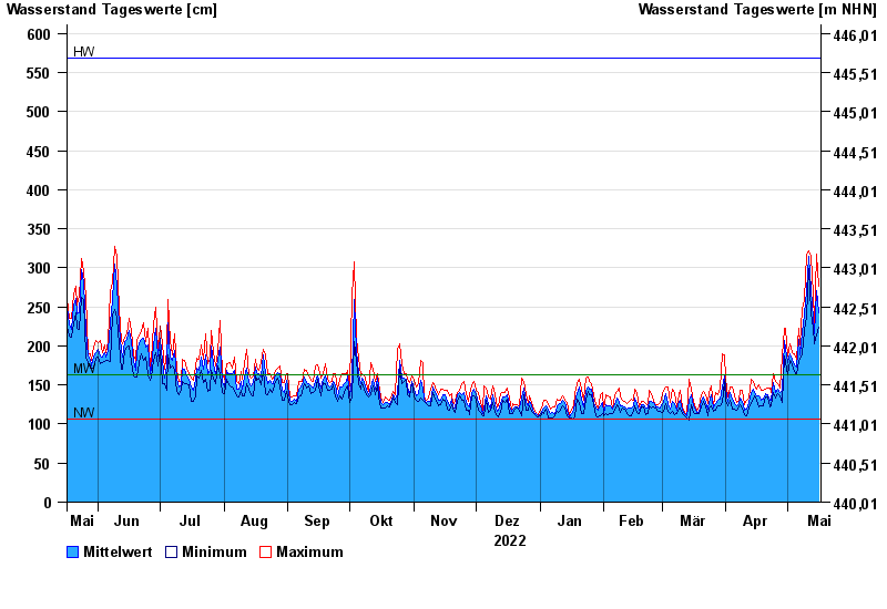
- Rosenheim o.d. Mangfallmündung >
- Chart of year

Chart of year Rosenheim o.d. Mangfallmündung / Inn
Waterlevel from 17.05.2022 to 16.05.2023
| Date | Mean value [cm] | Maximum [cm] | Minimum [cm] |
|---|---|---|---|
| 16.05.2023 | 243 | 277 | 224 |
| 15.05.2023 | 271 | 318 | 214 |
| 14.05.2023 | 215 | 230 | 203 |
| 13.05.2023 | 236 | 267 | 222 |
| 12.05.2023 | 272 | 315 | 242 |
| 11.05.2023 | 314 | 322 | 299 |
| 10.05.2023 | 269 | 318 | 237 |
© Bayerisches Landesamt für Umwelt 2024