
- Start >
- Rivers >
- Waterlevel >
- Isar >
- Rosenheim >
- Chart of year

Chart of year Rosenheim / Mangfall
Waterlevel from 24.07.2020 to 23.07.2021
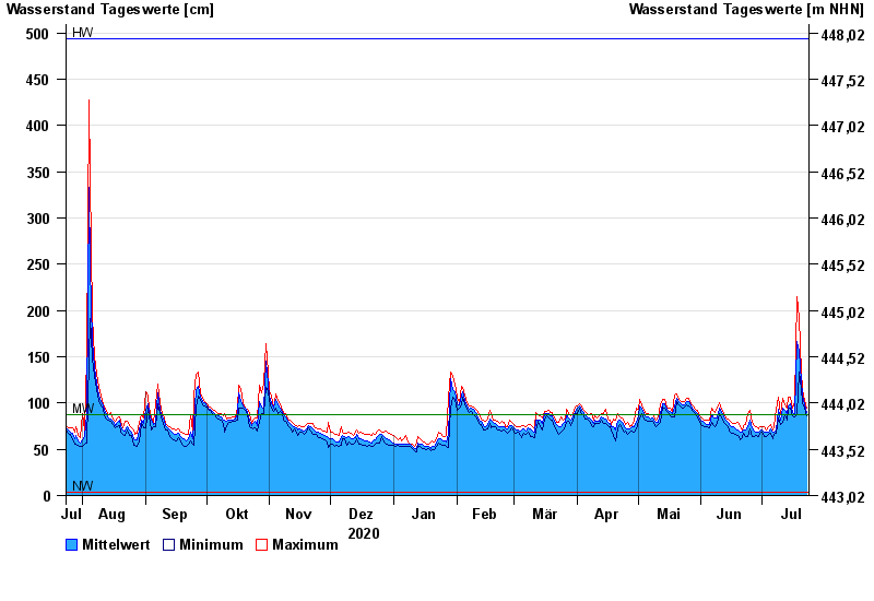
| Date | Mean value [cm] | Maximum [cm] | Minimum [cm] |
|---|---|---|---|
| 23.07.2021 | 90 | 94 | 86 |
| 22.07.2021 | 98 | 103 | 94 |
| 21.07.2021 | 108 | 115 | 100 |
| 20.07.2021 | 124 | 134 | 115 |
| 19.07.2021 | 156 | 193 | 134 |
| 18.07.2021 | 166 | 215 | 88 |
| 17.07.2021 | 89 | 101 | 85 |
© Bayerisches Landesamt für Umwelt 2024