
- Start >
- Rivers >
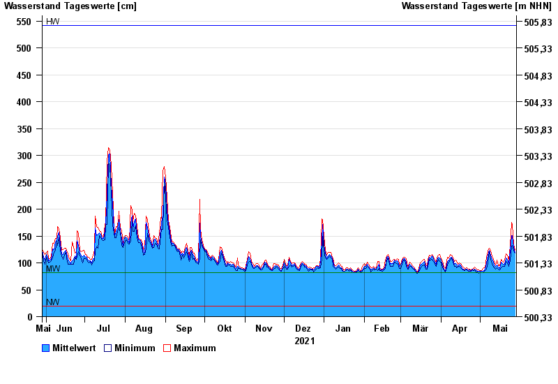
- Waterlevel >
- Isar >
- München >
- Chart of year

Chart of year München / Isar
Waterlevel from 29.05.2021 to 28.05.2022
| Date | Mean value [cm] | Maximum [cm] | Minimum [cm] |
|---|---|---|---|
| 28.05.2022 | 120 | 124 | 118 |
| 27.05.2022 | 128 | 134 | 122 |
| 26.05.2022 | 151 | 172 | 133 |
| 25.05.2022 | 151 | 175 | 130 |
| 24.05.2022 | 124 | 132 | 105 |
| 23.05.2022 | 99 | 105 | 93 |
| 22.05.2022 | 106 | 114 | 100 |
© Bayerisches Landesamt für Umwelt 2024