
- Start >
- Rivers >
- Waterlevel >
- Isar >
- Grafrath >
- Chart of year

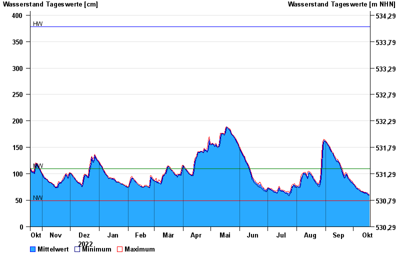
Chart of year Grafrath / Amper
Waterlevel from 19.10.2022 to 18.10.2023
| Date | Mean value [cm] | Maximum [cm] | Minimum [cm] |
|---|---|---|---|
| 18.10.2023 | 60 | 61 | 60 |
| 17.10.2023 | 61 | 62 | 60 |
| 16.10.2023 | 62 | 64 | 61 |
| 15.10.2023 | 64 | 64 | 63 |
| 14.10.2023 | 64 | 65 | 63 |
| 13.10.2023 | 64 | 65 | 63 |
| 12.10.2023 | 65 | 66 | 64 |
© Bayerisches Landesamt für Umwelt 2024