
- Start >
- Rivers >
- Waterlevel >
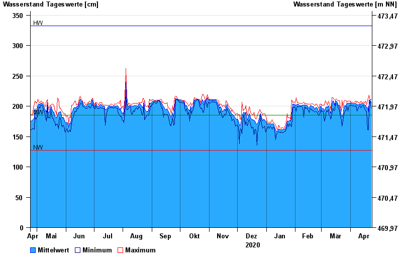
- Isar >
- Bad Aibling >
- Chart of year

Chart of year Bad Aibling / Triftbach linker Mühlkanal
Waterlevel from 24.04.2020 to 23.04.2021
| Date | Mean value [cm] | Maximum [cm] | Minimum [cm] |
|---|---|---|---|
| 23.04.2021 | 206 | 211 | 197 |
| 22.04.2021 | 210 | 210 | 209 |
| 21.04.2021 | 210 | 218 | 202 |
| 20.04.2021 | 191 | 215 | 161 |
| 19.04.2021 | 198 | 210 | 161 |
| 18.04.2021 | 197 | 202 | 192 |
| 17.04.2021 | 202 | 208 | 193 |
© Bayerisches Landesamt für Umwelt 2024