
- Start >
- Rivers >
- Waterlevel >
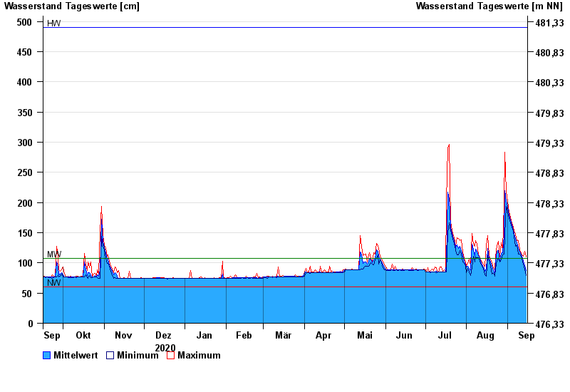
- Inn >
- Trostberg >
- Chart of year

Chart of year Trostberg / Alz
Waterlevel from 16.09.2020 to 15.09.2021
| Date | Mean value [cm] | Maximum [cm] | Minimum [cm] |
|---|---|---|---|
| 15.09.2021 | 87 | 110 | 79 |
| 14.09.2021 | 96 | 119 | 90 |
| 13.09.2021 | 103 | 111 | 98 |
| 12.09.2021 | 107 | 112 | 102 |
| 11.09.2021 | 114 | 116 | 111 |
| 10.09.2021 | 118 | 122 | 114 |
| 09.09.2021 | 125 | 137 | 115 |
© Bayerisches Landesamt für Umwelt 2024