
- Start >
- Rivers >
- Waterlevel >
- Inn >
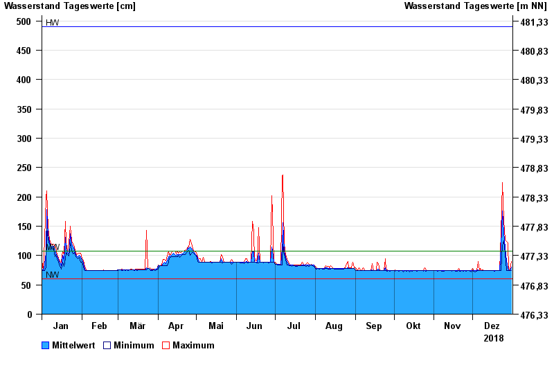
- Trostberg >
- Chart of year

Chart of year Trostberg / Alz
Waterlevel from 01.01.2018 to 31.12.2018
| Date | Mean value [cm] | Maximum [cm] | Minimum [cm] |
|---|---|---|---|
| 31.12.2018 | 80 | 90 | 75 |
| 30.12.2018 | 75 | 76 | 74 |
| 29.12.2018 | 75 | 75 | 75 |
| 28.12.2018 | 79 | 122 | 75 |
| 27.12.2018 | 91 | 124 | 75 |
| 26.12.2018 | 113 | 126 | 104 |
| 25.12.2018 | 139 | 161 | 125 |
© Bayerisches Landesamt für Umwelt 2024