
- Start >
- Rivers >
- Waterlevel >
- Inn >
- Staufeneck >
- Chart of year

Chart of year Staufeneck / Saalach
Waterlevel from 01.01.2023 to 31.12.2023
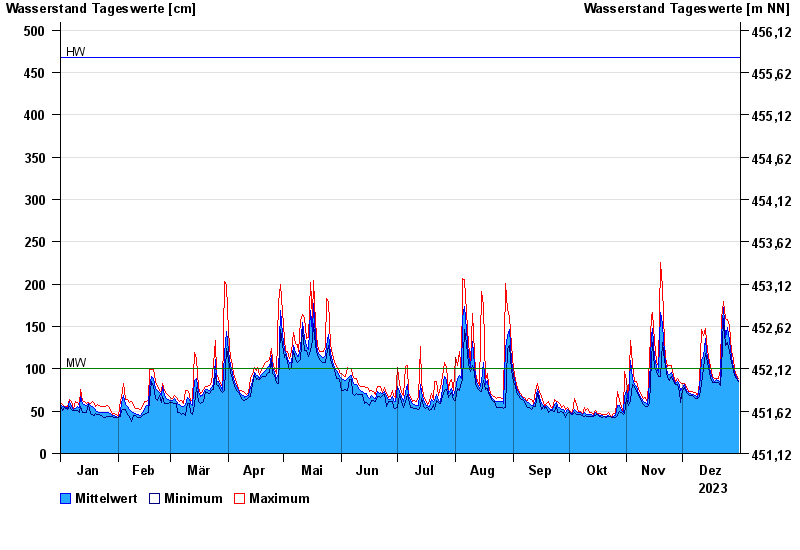
| Date | Mean value [cm] | Maximum [cm] | Minimum [cm] |
|---|---|---|---|
| 31.12.2023 | 86 | 88 | 85 |
| 30.12.2023 | 90 | 92 | 88 |
| 29.12.2023 | 95 | 99 | 92 |
| 28.12.2023 | 102 | 111 | 98 |
| 27.12.2023 | 113 | 121 | 107 |
| 26.12.2023 | 133 | 151 | 121 |
| 25.12.2023 | 149 | 158 | 131 |
© Bayerisches Landesamt für Umwelt 2024