
- Start >
- Rivers >
- Waterlevel >
- Inn >
- Schwöbbrücke >
- Chart of year

Chart of year Schwöbbrücke / Königsseer Ache
Waterlevel from 08.07.2020 to 07.07.2021
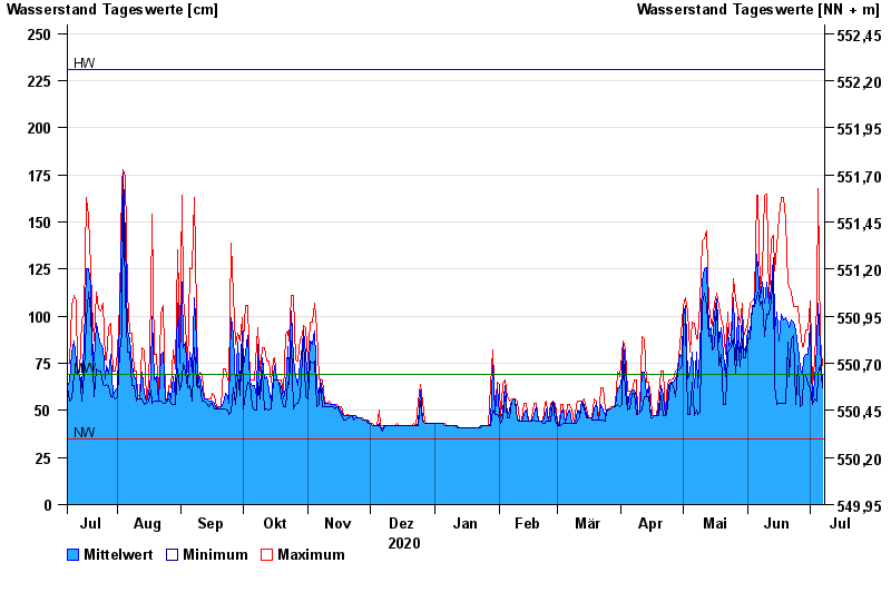
| Date | Mean value [cm] | Maximum [cm] | Minimum [cm] |
|---|---|---|---|
| 07.07.2021 | 64 | 74 | 62 |
| 06.07.2021 | 84 | 88 | 74 |
| 05.07.2021 | 107 | 168 | 69 |
| 04.07.2021 | 84 | 108 | 55 |
| 03.07.2021 | 66 | 76 | 56 |
| 02.07.2021 | 54 | 62 | 53 |
| 01.07.2021 | 95 | 108 | 62 |
© Bayerisches Landesamt für Umwelt 2024