
- Start >
- Rivers >
- Waterlevel >
- Inn >
- Schwöbbrücke >
- Chart of year

Chart of year Schwöbbrücke / Königsseer Ache
Waterlevel from 01.01.2022 to 31.12.2022
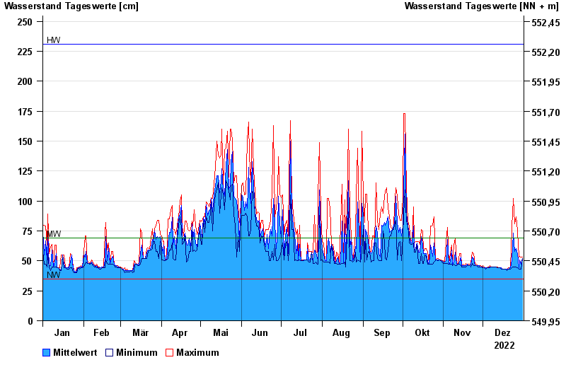
| Date | Mean value [cm] | Maximum [cm] | Minimum [cm] |
|---|---|---|---|
| 31.12.2022 | 52 | 53 | 52 |
| 30.12.2022 | 47 | 53 | 43 |
| 29.12.2022 | 51 | 54 | 43 |
| 28.12.2022 | 44 | 53 | 43 |
| 27.12.2022 | 56 | 75 | 44 |
| 26.12.2022 | 60 | 87 | 45 |
| 25.12.2022 | 58 | 81 | 45 |
© Bayerisches Landesamt für Umwelt 2024