
- Start >
- Rivers >
- Waterlevel >
- Inn >
- Gaißach >
- Chart of year

Chart of year Gaißach / Große Gaißach
Waterlevel from 29.10.2023 to 28.10.2024
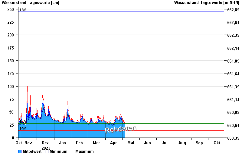
| Date | Mean value [cm] | Maximum [cm] | Minimum [cm] |
|---|---|---|---|
| 14.06.2024 | 37 | 38 | 36 |
| 13.06.2024 | 39 | 40 | 37 |
| 12.06.2024 | 42 | 44 | 37 |
| 11.06.2024 | 48 | 52 | 44 |
| 10.06.2024 | 64 | 76 | 52 |
| 09.06.2024 | 48 | 75 | 43 |
| 08.06.2024 | 42 | 51 | 36 |
© Bayerisches Landesamt für Umwelt 2024