
- Start >
- Rivers >
- Waterlevel >
- Iller - Lech - Bodensee >
- Rosenheim o.d. Mangfallmündung >
- Chart of year

Chart of year Rosenheim o.d. Mangfallmündung / Inn
Waterlevel from 04.08.2022 to 03.08.2023
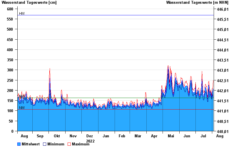
| Date | Mean value [cm] | Maximum [cm] | Minimum [cm] |
|---|---|---|---|
| 03.08.2023 | 207 | 248 | 166 |
| 02.08.2023 | 195 | 207 | 181 |
| 01.08.2023 | 185 | 209 | 165 |
| 31.07.2023 | 162 | 171 | 156 |
| 30.07.2023 | 181 | 189 | 166 |
| 29.07.2023 | 195 | 201 | 183 |
| 28.07.2023 | 177 | 184 | 168 |
© Bayerisches Landesamt für Umwelt 2024