
- Start >
- Rivers >
- Waterlevel >
- Iller - Lech - Bodensee >
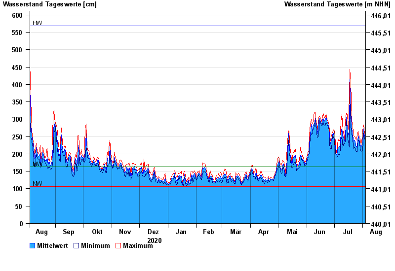
- Rosenheim o.d. Mangfallmündung >
- Chart of year

Chart of year Rosenheim o.d. Mangfallmündung / Inn
Waterlevel from 04.08.2020 to 03.08.2021
| Date | Mean value [cm] | Maximum [cm] | Minimum [cm] |
|---|---|---|---|
| 03.08.2021 | 251 | 260 | 243 |
| 02.08.2021 | 272 | 283 | 259 |
| 01.08.2021 | 240 | 267 | 208 |
| 31.07.2021 | 228 | 246 | 209 |
| 30.07.2021 | 219 | 227 | 207 |
| 29.07.2021 | 227 | 243 | 217 |
| 28.07.2021 | 243 | 249 | 236 |
© Bayerisches Landesamt für Umwelt 2024