
- Start >
- Rivers >
- Waterlevel >
- Iller - Lech - Bodensee >
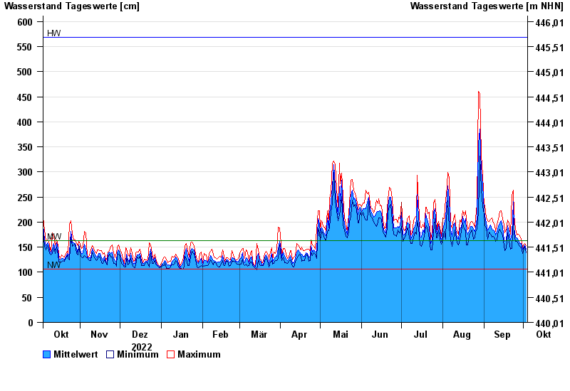
- Rosenheim o.d. Mangfallmündung >
- Chart of year

Chart of year Rosenheim o.d. Mangfallmündung / Inn
Waterlevel from 04.10.2022 to 03.10.2023
| Date | Mean value [cm] | Maximum [cm] | Minimum [cm] |
|---|---|---|---|
| 03.10.2023 | 146 | 153 | 139 |
| 02.10.2023 | 154 | 158 | 151 |
| 01.10.2023 | 147 | 155 | 140 |
| 30.09.2023 | 146 | 150 | 138 |
| 29.09.2023 | 158 | 166 | 150 |
| 28.09.2023 | 158 | 173 | 151 |
| 27.09.2023 | 165 | 176 | 156 |
© Bayerisches Landesamt für Umwelt 2024